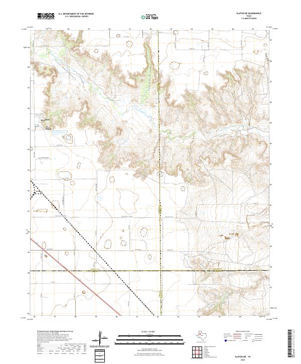
2022 Map of Slaton NE
USGS Topo · Published 2022About this map
Yellow House Canyon cuts a winding path through the high plains of the Texas Panhandle, where the N Fork Double Mountain Fork Brazos River creates a complex network of drainage systems including Long Hollow Canyon and Turkey Draw. This 2022 survey captures the eastern edge of Slaton, showing its transition from an organized street grid to the expansive agricultural and ranching lands that dominate the South Plains. The landscape is defined by the sharp contrast between the level cotton fields and the broken terrain of the river breaks, particularly where Spring Cr and Harvey Cr meet. Local road names like Dora Pinkert Drvw and Lazy K Rd provide specific family-history touchpoints amidst a landscape shaped by four county intersections: Lubbock, Crosby, Lynn, and Garza.
Find a feature on this map
41 named features on this map. Tap any name to fly to it.
Don’t see what you’re looking for? This feature index may not catch every label — zoom into the map to look around manually.
Map Details
Editions of this 2022 Slaton NE Map
This is the sole edition of this map. No revisions or reprints were ever made.
Other maps of this area

1954 · Lubbock
USGS Topo · 1:250,000

1965 · Acuff
USGS Topo · 1:24,000

1965 · Slaton
USGS Topo · 1:24,000

1965 · Buffalo Springs Lake
USGS Topo · 1:24,000

1965 · Southland
USGS Topo · 1:24,000

1965 · Wilson
USGS Topo · 1:24,000

1965 · Slaton NE
USGS Topo · 1:24,000

1966 · Cap Rock
USGS Topo · 1:24,000

1967 · Savage
USGS Topo · 1:24,000

1968 · South Dokegood Creek
USGS Topo · 1:24,000