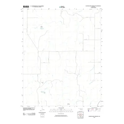
2010 Map of Sleeping Bear Creek NW
USGS Topo · Published 2010About this map
Fern Cemetery lies in the eastern portion of this Harper County landscape, marking a quiet point of local heritage amidst a network of managed water resources. The terrain is defined by the winding paths of Sand Creek and Gilbert Creek, which feed into several small-scale water projects. The engineering of the local cattle or agricultural water supply is evident through features like the Selman Gp1 Reservoir and its associated Selman Gp1 Dam, along with the Kinney 5 Reservoir.
Find a feature on this map
21 named features on this map. Tap any name to fly to it.
Don’t see what you’re looking for? This feature index may not catch every label — zoom into the map to look around manually.
Map Details
Editions of this 2010 Sleeping Bear Creek NW Map
This is the sole edition of this map. No revisions or reprints were ever made.
Other maps of this area

1955 · Woodward
USGS Topo · 1:250,000

1958 · Woodward
USGS Topo · 1:250,000

1970 · Buffalo SE
USGS Topo · 1:24,000

1970 · Sleeping Bear Creek SW
USGS Topo · 1:24,000

1970 · Sleeping Bear Creek NW
USGS Topo · 1:24,000

1970 · Sleeping Bear Creek SE
USGS Topo · 1:24,000

1971 · Selman SE
USGS Topo · 1:24,000

1971 · Fort Supply
USGS Topo · 1:24,000

1971 · Selman
USGS Topo · 1:24,000

1971 · Fort Supply NE
USGS Topo · 1:24,000