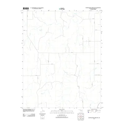
2012 Map of Sleeping Bear Creek NW
USGS Topo · Published 2012About this map
Sand Cr and its various tributaries carve through this section of the Oklahoma plains in Harper County, creating a drainage pattern that defines the local ranching and agricultural landscape. The map shows a system of section-line roads, such as n2000 RD and e0220 RD, which organize the territory into a precise grid characteristic of the Great Plains. Water management is a central feature of the area, evidenced by the Selman Gp1 Reservoir in the north and the Kinney 5 Reservoir to the south. For genealogists and local historians, the Fern Cem near Gilbert Cr serves as a significant landmark of early community settlement in this rural expanse.
Find a feature on this map
19 named features on this map. Tap any name to fly to it.
Don’t see what you’re looking for? This feature index may not catch every label — zoom into the map to look around manually.
Map Details
Editions of this 2012 Sleeping Bear Creek NW Map
This is the sole edition of this map. No revisions or reprints were ever made.
Other maps of this area

1955 · Woodward
USGS Topo · 1:250,000

1958 · Woodward
USGS Topo · 1:250,000

1970 · Buffalo SE
USGS Topo · 1:24,000

1970 · Sleeping Bear Creek SW
USGS Topo · 1:24,000

1970 · Sleeping Bear Creek NW
USGS Topo · 1:24,000

1970 · Sleeping Bear Creek SE
USGS Topo · 1:24,000

1971 · Selman SE
USGS Topo · 1:24,000

1971 · Fort Supply
USGS Topo · 1:24,000

1971 · Selman
USGS Topo · 1:24,000

1971 · Fort Supply NE
USGS Topo · 1:24,000