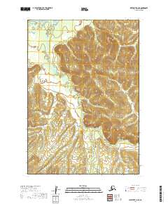
2019 Map of Sleetmute A-4 SE
USGS Topo · Published 2019About this map
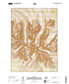
Taylor Creek and its tributary Taylor Cr wind through the northern reaches of this interior Alaskan landscape, shaping the drainage patterns within the boundaries of t12n r45w. Further south, Stevens Cr cuts across the terrain in t11n r45w, illustrating the remote hydrological network characteristic of the Bethel Census Area. The topography is defined by significant elevation changes, with ridges rising between the creek beds, providing a clear picture of the natural landforms before any modern development or infrastructure. This data, compiled from various sources including the National Hydrography Dataset, focuses on the untouched character of the wilderness in the early twenty-first century.
Find a feature on this map
7 named features on this map. Tap any name to fly to it.
Don’t see what you’re looking for? This feature index may not catch every label — zoom into the map to look around manually.
Map Details
Editions of this 2019 Sleetmute A-4 SE Map
This is the sole edition of this map. No revisions or reprints were ever made.
Other maps of this area

1950 · Sleetmute
USGS Topo · 1:250,000

1950 · Taylor Mountains
USGS Topo · 1:250,000

1951 · Taylor Mountains
USGS Topo · 1:250,000

1954 · Sleetmute
USGS Topo · 1:250,000

1954 · Taylor Mountains
USGS Topo · 1:250,000
1954 · Taylor Mountains D-3
USGS Topo · 1:63,360
1954 · Sleetmute A-3
USGS Topo · 1:63,360
1954 · Sleetmute A-4
USGS Topo · 1:63,360

1954 · Taylor Mountains D-4
USGS Topo · 1:63,360
2019 · Taylor Mountains D-4 NW
USGS Topo · 1:25,000