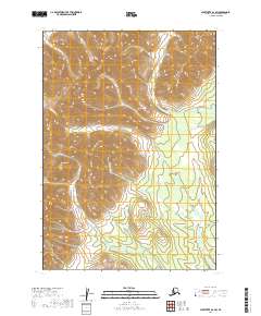
2019 Map of Sleetmute A-6 SW
USGS Topo · Published 2019About this map
The interior landscape of the t12n r50w and t12n r51w townships is defined by an intricate network of alpine drainage systems. Dominating the central topography, Muksulik Cr flows through the heart of the quadrangle, joined by tributaries like Fortyseven Cr in the southeast. This 2019 survey by the U.S. Geological Survey reveals a terrain devoid of permanent settlements or road infrastructure, typical of the Bethel Census Area's remote character. Instead, the map traces the natural contours of the Kuskokwim River watershed, highlighting local watercourses such as Bakbuk Cr, Boss Cr, and Etozuk Cr. The drainage patterns and elevation data provide essential context for understanding the hydrology of this roadless region of Southwest Alaska.
Find a feature on this map
9 named features on this map. Tap any name to fly to it.
Don’t see what you’re looking for? This feature index may not catch every label — zoom into the map to look around manually.
Map Details
Editions of this 2019 Sleetmute A-6 SW Map
This is the sole edition of this map. No revisions or reprints were ever made.
Other maps of this area

1950 · Sleetmute
USGS Topo · 1:250,000

1950 · Taylor Mountains
USGS Topo · 1:250,000

1951 · Taylor Mountains
USGS Topo · 1:250,000

1954 · Sleetmute
USGS Topo · 1:250,000

1954 · Taylor Mountains
USGS Topo · 1:250,000

1954 · Sleetmute A-7
USGS Topo · 1:63,360

1954 · Taylor Mountains D-6
USGS Topo · 1:63,360

1954 · Sleetmute A-6
USGS Topo · 1:63,360
1954 · Taylor Mountains D-7
USGS Topo · 1:63,360
2019 · Taylor Mountains D-6 NE
USGS Topo · 1:25,000