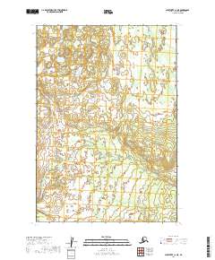
2019 Map of Sleetmute C-1 NE
USGS Topo · Published 2019About this map
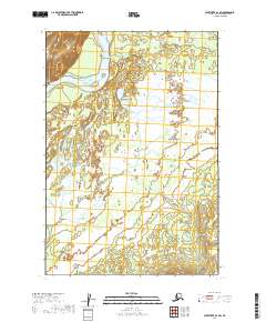
The interior of the Bethel Census Area is defined by expansive wetland systems and subtle topography in this 2019 survey. This specific quadrant is dominated by the Public Land Survey System divisions of T19n R38w, T19n R37w, T18n R38w, and T18n R37w. The landscape is a complex network of small ponds and saturated terrain, illustrating the hydrological character of the Alaskan wilderness before significant human infrastructure. Sparse contour lines indicate a largely level environment where water drainage patterns dictate the geography, providing a baseline for environmental researchers and those studying the remote reaches of the Kuskokwim River region.
Find a feature on this map
4 named features on this map. Tap any name to fly to it.
Don’t see what you’re looking for? This feature index may not catch every label — zoom into the map to look around manually.
Map Details
Editions of this 2019 Sleetmute C-1 NE Map
This is the sole edition of this map. No revisions or reprints were ever made.
Other maps of this area

1950 · Sleetmute
USGS Topo · 1:250,000

1951 · Lime Hills
USGS Topo · 1:250,000

1954 · Sleetmute D-1
USGS Topo · 1:63,360

1954 · Sleetmute C-1
USGS Topo · 1:63,360
1954 · Lime Hills D-8
USGS Topo · 1:63,360

1954 · Sleetmute
USGS Topo · 1:250,000
1958 · Lime Hills C-8
USGS Topo · 1:63,360

1958 · Lime Hills
USGS Topo · 1:250,000
2019 · Lime Hills C-8 SW
USGS Topo · 1:25,000
2019 · Sleetmute D-1 SW
USGS Topo · 1:25,000