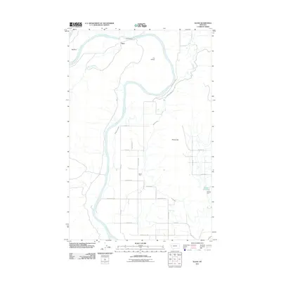
2011 Map of Sloan
USGS Topo · Published 2011About this map
The Flathead River defines the geography of this northern Montana landscape, carving dramatic features such as Big Bend and The Oxbow as it moves through Sanders County. The settlement at Sloan is situated near the Sloan Bridge, where the river meets the Little Bitterroot River. The mapping reveals a highly structured irrigation and agricultural network established in the valley, evidenced by the Moiese A Canal, the Moiese 30-13 Lateral, and the Hillside Ditch.
Find a feature on this map
29 named features on this map. Tap any name to fly to it.
Don’t see what you’re looking for? This feature index may not catch every label — zoom into the map to look around manually.
Map Details
Editions of this 2011 Sloan Map
This is the sole edition of this map. No revisions or reprints were ever made.
Other maps of this area

1920 · Flathead Lake
USGS Topo · 1:125,000

1956 · Wallace
USGS Topo · 1:250,000

1960 · Wallace
USGS Topo · 1:250,000

1964 · Dixon
USGS Topo · 1:24,000

1964 · Mc Donald
USGS Topo · 1:24,000

1964 · Melton Ranch
USGS Topo · 1:24,000

1964 · Lower Crow Reservoir
USGS Topo · 1:24,000

1964 · Ravalli
USGS Topo · 1:24,000

1965 · Sloan
USGS Topo · 1:24,000

1965 · Oliver Point
USGS Topo · 1:24,000