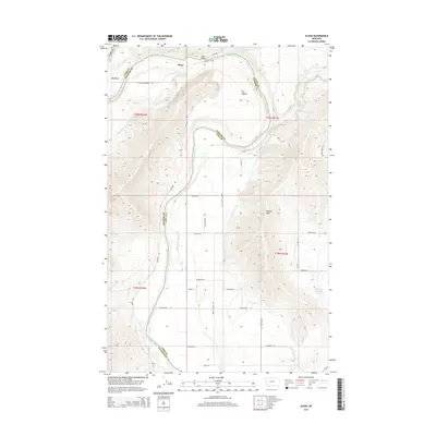
2014 Map of Sloan
USGS Topo · Published 2014About this map
The Flathead River carves a dramatic path through this Montana landscape, defining the border between Sanders and Lake Counties. Near the small settlement of Sloan, the river makes a sharp northern turn at Big Bend before looping around a prominent landform known as The Oxbow. This 2014 survey reveals an intricate irrigation network supporting the local agriculture, including the Moiese A Canal, the Hillside Ditch, and the Moiese 30-13 Lateral, which feed into the Hillside Reservoir. To the south, the Moiese Hills rise above the valley floor, overlooking a grid of rural roads and land sections. The convergence of the Little Bitterroot River and the main channel, connected by the Sloan Bridge, illustrates the historical and functional importance of this river crossing for the surrounding ranching and farming community.
Find a feature on this map
74 named features on this map. Tap any name to fly to it.
Don’t see what you’re looking for? This feature index may not catch every label — zoom into the map to look around manually.
Map Details
Editions of this 2014 Sloan Map
This is the sole edition of this map. No revisions or reprints were ever made.
Other maps of this area

1920 · Flathead Lake
USGS Topo · 1:125,000

1956 · Wallace
USGS Topo · 1:250,000

1960 · Wallace
USGS Topo · 1:250,000

1964 · Dixon
USGS Topo · 1:24,000

1964 · Mc Donald
USGS Topo · 1:24,000

1964 · Melton Ranch
USGS Topo · 1:24,000

1964 · Lower Crow Reservoir
USGS Topo · 1:24,000

1964 · Ravalli
USGS Topo · 1:24,000

1965 · Sloan
USGS Topo · 1:24,000

1965 · Oliver Point
USGS Topo · 1:24,000