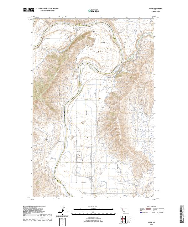
2024 Map of Sloan
USGS Topo · Published 2024About this map
The Flathead River carves a dramatic path through this Montana landscape, defined by a massive meander known as The Oxbow north of the Cabinet Mountains. The settlement of Sloan sits at the river's edge, anchoring a territory where the rugged slopes of the Moiese Hills transition into an complex network of valley irrigation. A sophisticated water management system is visible throughout the lowlands, featuring the Moiese 30-13 Canal, the Moiese A Canal, and the Hillside Ditch, which feed into the Hillside Reservoir.
Find a feature on this map
34 named features on this map. Tap any name to fly to it.
Don’t see what you’re looking for? This feature index may not catch every label — zoom into the map to look around manually.
Map Details
Editions of this 2024 Sloan Map
This is the sole edition of this map. No revisions or reprints were ever made.
Other maps of this area

1920 · Flathead Lake
USGS Topo · 1:125,000

1956 · Wallace
USGS Topo · 1:250,000

1960 · Wallace
USGS Topo · 1:250,000

1964 · Dixon
USGS Topo · 1:24,000

1964 · Mc Donald
USGS Topo · 1:24,000

1964 · Melton Ranch
USGS Topo · 1:24,000

1964 · Lower Crow Reservoir
USGS Topo · 1:24,000

1964 · Ravalli
USGS Topo · 1:24,000

1965 · Sloan
USGS Topo · 1:24,000

1965 · Oliver Point
USGS Topo · 1:24,000