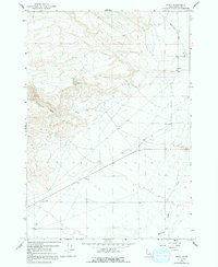
1964 Map of Small
USGS Topo · Published 1991About this map
Small serves as the primary focal point in this high-desert landscape of Clark County, situated along the upper reaches of Medicine Lodge Creek. The 1964 field check reveals a community defined by its proximity to vital water sources and early extraction efforts, where Deep Creek cuts through the western terrain to join the main drainage. Resource utilization is evident in the presence of several Gravel Pits and a solitary Prospect located near a seasonal Spring. The map illustrates a network of 4WD tracks that spiderweb across the township boundaries, indicating the transition from established valley settlements to the higher, more demanding livestock and mining country of eastern Idaho.
Find a feature on this map
17 named features on this map. Tap any name to fly to it.
Don’t see what you’re looking for? This feature index may not catch every label — zoom into the map to look around manually.
Map Details
Editions of this 1964 Small Map
2 editions found
Other maps of this area

1955 · Dubois
USGS Topo · 1:250,000

1957 · Paul Reservoir
USGS Topo · 1:62,500

1957 · Edie Ranch
USGS Topo · 1:62,500

1958 · Dubois
USGS Topo · 1:250,000

1964 · Lone Butte
USGS Topo · 1:24,000

1964 · Small
USGS Topo · 1:24,000

1964 · Cedar Butte SW
USGS Topo · 1:24,000

1964 · Cedar Butte SE
USGS Topo · 1:24,000

1969 · Lidy Hot Springs SE
USGS Topo · 1:24,000

1969 · Lidy Hot Springs
USGS Topo · 1:24,000