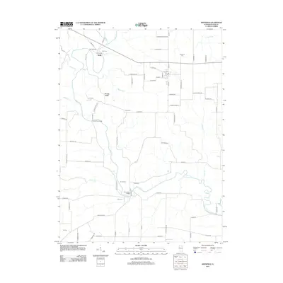
2012 Map of Smithfield
USGS Topo · Published 2012About this map
The Spoon River meanders through the heart of this Fulton County landscape, carving a valley that defines the local geography. Significant river crossings like the Seville Bridge, Tartars Ferry Bridge, and Bernadotte Bridge highlight the historical importance of the waterway to regional transit. The small settlement of Seville sits near the northern bend of the river, while the surrounding uplands include named features such as Poverty Ridge and numerous small tributaries like Barker Cr and Badger Cr. For genealogists and local historians, the area is notably dense with family-named burial grounds, including Fuller Cem, Baughman Cem, Howard Cem, and Stites Cem, often situated near older farmstead sites such as Turner Farms. This 2012 survey documents the persistent rural character and agricultural network of the Illinois prairie.
Find a feature on this map
74 named features on this map. Tap any name to fly to it.
Don’t see what you’re looking for? This feature index may not catch every label — zoom into the map to look around manually.
Map Details
Editions of this 2012 Smithfield Map
This is the sole edition of this map. No revisions or reprints were ever made.
Other maps of this area

1912 · Canton
USGS Topo · 1:62,500

1915 · Avon
USGS Topo · 1:62,500

1918 · Vermont
USGS Topo · 1:62,500

1921 · Vermont
USGS Topo · 1:62,500

1925 · Havana
USGS Topo · 1:62,500

1944 · Avon
USGS Topo · 1:62,500

1947 · Lewistown
USGS Topo · 1:24,000

1947 · Vermont
USGS Topo · 1:24,000

1947 · Adair
USGS Topo · 1:24,000

1948 · Duncan Mills
USGS Topo · 1:24,000