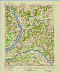
1942 Map of Smithland
USGS Topo · Published 1957About this map
The confluence of the Cumberland River and Ohio River centers this 1942 survey, highlighting Smithland as a vital river junction in western Kentucky. The map documents an intricate network of river landings and crossings, such as Haddox Ferry, Lemmon Landing, and Upper Hodge Landing, reflecting a landscape deeply tied to waterborne commerce and transit. To the south, the Tennessee River flows toward Gilbertsville, where Mile Island sits in the channel near the border of Livingston and Marshall Counties.
Find a feature on this map
111 named features on this map. Tap any name to fly to it.
Don’t see what you’re looking for? This feature index may not catch every label — zoom into the map to look around manually.
Map Details
Editions of this 1942 Smithland Map
This is the sole edition of this map. No revisions or reprints were ever made.
Other maps of this area

1916 · Fords Ferry
USGS Topo · 1:62,500

1916 · Golconda
USGS Topo · 1:62,500

1917 · Brownfield
USGS Topo · 1:62,500

1920 · Goloonda
USGS Topo · 1:48,000

1921 · Fords Ferry
USGS Topo · 1:48,000

1921 · Golconda
USGS Topo · 1:62,500

1925 · Cave In Rock
USGS Topo · 1:62,500

1926 · Paducah
USGS Topo · 1:62,500

1928 · Eddyville
USGS Topo · 1:48,000

1929 · Smithland
USGS Topo · 1:62,500