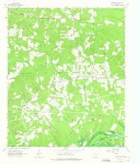
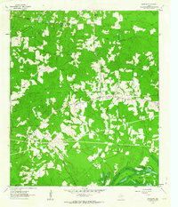
1962 Map of Smithland
USGS Topo · Published 1975About this map
The community of Smithland serves as the central hub of this East Texas landscape, where the local economy and geography are defined by a network of rural churches and early industrial infrastructure. The northern portion of the sheet is dominated by the Rodessa Field oil operations, with numerous pipelines and wells integrated into the wooded terrain. Historical transportation patterns are visible through an Old Railroad Grade that cuts through the northeast corner near Jim Bayou.
Find a feature on this map
28 named features on this map. Tap any name to fly to it.
Don’t see what you’re looking for? This feature index may not catch every label — zoom into the map to look around manually.
Map Details
Editions of this 1962 Smithland Map
3 editions found
Other maps of this area

1944 · Kildare
USGS Topo · 1:62,500

1944 · Caddo Lake
USGS Topo · 1:62,500

1946 · Caddo Lake
USGS Topo · 1:62,500

1948 · Kildare
USGS Topo · 1:62,500

1956 · Tyler
USGS Topo · 1:250,000
1962 · McLeod
USGS Topo · 1:24,000

1962 · Lanier
USGS Topo · 1:24,000
1962 · Trees
USGS Topo · 1:24,000

1962 · Woodlawn
USGS Topo · 1:24,000
1962 · Smithland
USGS Topo · 1:24,000