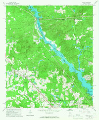
1965 Map of Smiths
USGS Topo · Published 1967About this map
The Chattahoochee River corridor along the Alabama-Georgia border defines this mid-1960s landscape, featuring significant hydroelectric infrastructure at Goat Rock Dam and Oliver Dam. The creation of Lake Oliver has transformed the river valley, though the original course is still traced by the state line passing Phillips Island. Inland from the river, the settlement of Smiths serves as a local hub, situated along the Central of Georgia railroad line.
Find a feature on this map
59 named features on this map. Tap any name to fly to it.
Don’t see what you’re looking for? This feature index may not catch every label — zoom into the map to look around manually.
Map Details
Editions of this 1965 Smiths Map
3 editions found
Other maps of this area

1907 · Talbotton
USGS Topo · 1:125,000

1907 · Opelika
USGS Topo · 1:125,000

1908 · Columbus
USGS Topo · 1:62,500

1909 · Opelika
USGS Topo · 1:125,000

1914 · Seale
USGS Topo · 1:62,500

1929 · Columbus
USGS Topo · 1:48,000

1947 · Columbus
USGS Topo · 1:62,500

1949 · Columbus
USGS Topo · 1:24,000

1950 · Fortson
USGS Topo · 1:24,000

1950 · Mulberry Grove
USGS Topo · 1:24,000
Featured Places
- Columbus, GA
- Phenix City, AL
- Smiths Station, AL
- Monterey Heights, Smiths Station
- Carriage Hill, Phenix City