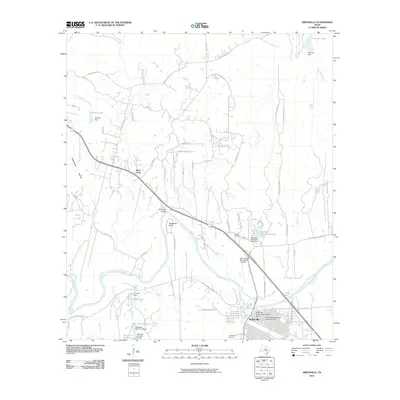
2010 Map of Smithville
USGS Topo · Published 2010About this map
The Colorado River defines the landscape of this Central Texas quadrangle, winding past Hardeman Bend and Kennedy Bluffs toward the town of Smithville. The local street grid is remarkably preserved, featuring both the Smithville Commercial Historic District and the Smithville Residential Historic District, showcasing the area's established architectural heritage. Transportation corridors like FM 153 Farm-To-Market Rd and the historic Gotier Trace Rd connect the town to the surrounding countryside, where small settlements like Alum Creek and family landmarks such as Powell Cemetery and Thompson Cemetery anchor the rural landscape.
Find a feature on this map
70 named features on this map. Tap any name to fly to it.
Don’t see what you’re looking for? This feature index may not catch every label — zoom into the map to look around manually.
Map Details
Editions of this 2010 Smithville Map
This is the sole edition of this map. No revisions or reprints were ever made.
Other maps of this area

1885 · Bastrop
USGS Topo · 1:125,000

1893 · Bastrop
USGS Topo · 1:125,000

1901 · Flatonia
USGS Topo · 1:125,000

1904 · Bastrop
USGS Topo · 1:125,000

1948 · Smithville
USGS Topo · 1:62,500

1948 · Bastrop
USGS Topo · 1:62,500

1950 · Bastrop
USGS Topo · 1:62,500

1950 · Smithville
USGS Topo · 1:62,500

1953 · Seguin
USGS Topo · 1:250,000

1954 · Austin
USGS Topo · 1:250,000