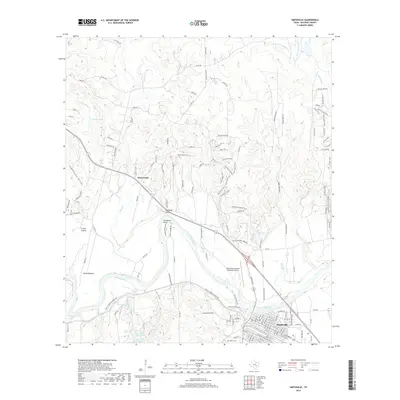
2019 Map of Smithville
USGS Topo · Published 2019About this map
The Colorado River carves a deep path through Bastrop County, anchoring the landscape around Smithville. This modern survey illustrates the town's position at the intersection of river and rail, where Gazley Cr meets the main channel. To the northwest, the settlement of Alum Creek is defined by its namesake waterway and the prominent elevation of Loma Alta. Genealogists will find interest in the documented locations of Gazley Cem and Powell Cem, while the rugged river geography is further detailed at Kennedy Bluffs and the large meander of Hardeman Bend. The topography shifts from the river bottomlands at David Bottom to the upland forests near Buescher Lake. Transportation infrastructure is well-established, featuring the Smithville Crawford Municipal Airport and a dense network of local routes like Alum Creek Rd and FM 2571 Farm-to-Market Rd serving the outlying Crafts Prairie area.
Find a feature on this map
129 named features on this map. Tap any name to fly to it.
Don’t see what you’re looking for? This feature index may not catch every label — zoom into the map to look around manually.
Map Details
Editions of this 2019 Smithville Map
This is the sole edition of this map. No revisions or reprints were ever made.
Other maps of this area

1885 · Bastrop
USGS Topo · 1:125,000

1893 · Bastrop
USGS Topo · 1:125,000

1901 · Flatonia
USGS Topo · 1:125,000

1904 · Bastrop
USGS Topo · 1:125,000

1948 · Smithville
USGS Topo · 1:62,500

1948 · Bastrop
USGS Topo · 1:62,500

1950 · Bastrop
USGS Topo · 1:62,500

1950 · Smithville
USGS Topo · 1:62,500

1953 · Seguin
USGS Topo · 1:250,000

1954 · Austin
USGS Topo · 1:250,000