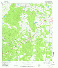
1982 Map of Smithville NW
USGS Topo · Published 1982About this map
Gotier Trace cuts through this Bastrop County landscape, marking a historic route through the Texas interior during the early 1980s. The map reveals a rural community defined by its watercourses and family-named landmarks, where Alum Creek and Pin Oak Creek drain the wooded terrain. Religious and social life centers on Ridgeway Ch and the Milton Chapel area, while the Southern Pacific line provides a clear industrial contrast to the surrounding natural features. Genealogists will find significant value in the documentation of local burial grounds, including Dixon Prairie Cem, Burkhardt Cem, and Ridgeway Cem. The presence of several distinct springs, such as Hoppy Spring and Pole Spring, alongside numerous wells, underscores the importance of local water sources in this region north of Smithville.
Find a feature on this map
29 named features on this map. Tap any name to fly to it.
Don’t see what you’re looking for? This feature index may not catch every label — zoom into the map to look around manually.
Map Details
Editions of this 1982 Smithville NW Map
2 editions found
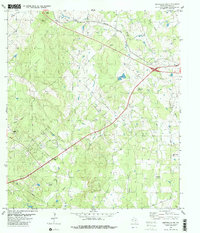
Other maps of this area

1885 · Bastrop
USGS Topo · 1:125,000

1893 · Bastrop
USGS Topo · 1:125,000

1904 · Bastrop
USGS Topo · 1:125,000

1948 · Smithville
USGS Topo · 1:62,500

1948 · Elgin
USGS Topo · 1:62,500

1948 · Bastrop
USGS Topo · 1:62,500

1948 · Lexington
USGS Topo · 1:62,500

1950 · Lexington
USGS Topo · 1:62,500

1950 · Bastrop
USGS Topo · 1:62,500

1950 · Smithville
USGS Topo · 1:62,500