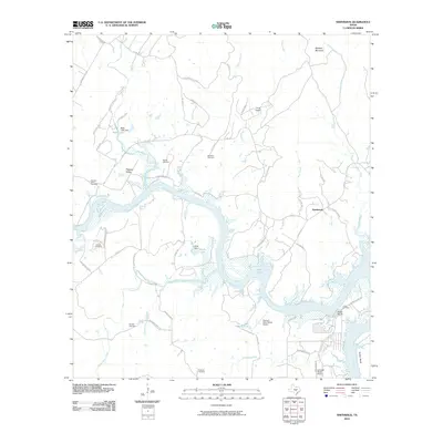
2010 Map of Smithwick
USGS Topo · Published 2010About this map
Lake Travis dominates the center of this landscape, where the Colorado River winds through the Hill Country. The community of Smithwick sits near the confluence of Post Creek and Hickory Creek, serving as a central point for a region defined by its waterway-based ranching and recreation. The map reveals a high density of small family and community burial grounds, including Pangle Cemetery, Richland Cemetery, and Burnam Cemetery, which suggest a long-established rural settlement pattern along the river valleys. Smaller impoundments like Lewis Lake and Bible Lake are found north of the main river channel, while prominent landmarks like Eagle Bluffs and Wildcat Mountain frame the horizon. The presence of Flying X River Ranch Airport and Lakeside Beach Airport indicates the development of residential fly-in communities and recreational access points along the expansive shoreline.
Find a feature on this map
65 named features on this map. Tap any name to fly to it.
Don’t see what you’re looking for? This feature index may not catch every label — zoom into the map to look around manually.
Map Details
Editions of this 2010 Smithwick Map
This is the sole edition of this map. No revisions or reprints were ever made.
Other maps of this area

1887 · Blanco
USGS Topo · 1:125,000

1887 · Burnet
USGS Topo · 1:125,000

1893 · Burnet
USGS Topo · 1:125,000

1894 · Blanco
USGS Topo · 1:125,000

1903 · Burnet
USGS Topo · 1:125,000

1909 · Burnet
USGS Topo · 1:125,000

1925 · Burnet 3-d
USGS Topo · 1:48,000

1929 · Marble Falls
USGS Topo · 1:62,500

1930 · Blanco-1
USGS Topo · 1:48,000

1932 · Marble Falls
USGS Topo · 1:62,500