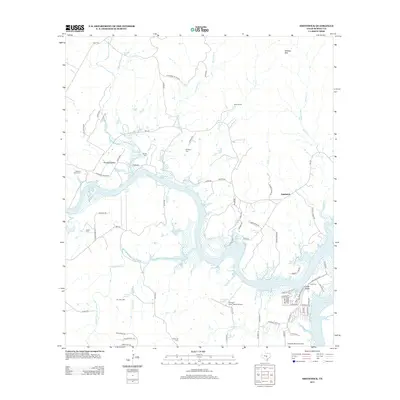
2012 Map of Smithwick
USGS Topo · Published 2012About this map
Lake Travis dominates the southern landscape of this Texas Hill Country quadrangle, where the winding Colorado River basin meets the rugged uplands of Burnet County. The settlement of Smithwick serves as a local focal point, surrounded by a terrain defined by deep-cutting tributaries like Sycamore Cr and Post Cr. For family historians, the sheet is particularly dense with small burial grounds, including Pleasant Valley Cem, Richland Cem, and Burnam Cem, which are scattered among the ranch lands. The presence of Flying X River Ranch Airport and Lakeside Beach Airport highlights the mix of traditional rural life and modern recreational development along the water's edge. Notable landmarks such as Wildcat Mtn and the Eagle Bluffs overlook the complex hydrology of Lewis Lake and Double Horn Cr.
Find a feature on this map
81 named features on this map. Tap any name to fly to it.
Don’t see what you’re looking for? This feature index may not catch every label — zoom into the map to look around manually.
Map Details
Editions of this 2012 Smithwick Map
This is the sole edition of this map. No revisions or reprints were ever made.
Other maps of this area

1887 · Blanco
USGS Topo · 1:125,000

1887 · Burnet
USGS Topo · 1:125,000

1893 · Burnet
USGS Topo · 1:125,000

1894 · Blanco
USGS Topo · 1:125,000

1903 · Burnet
USGS Topo · 1:125,000

1909 · Burnet
USGS Topo · 1:125,000

1925 · Burnet 3-d
USGS Topo · 1:48,000

1929 · Marble Falls
USGS Topo · 1:62,500

1930 · Blanco-1
USGS Topo · 1:48,000

1932 · Marble Falls
USGS Topo · 1:62,500