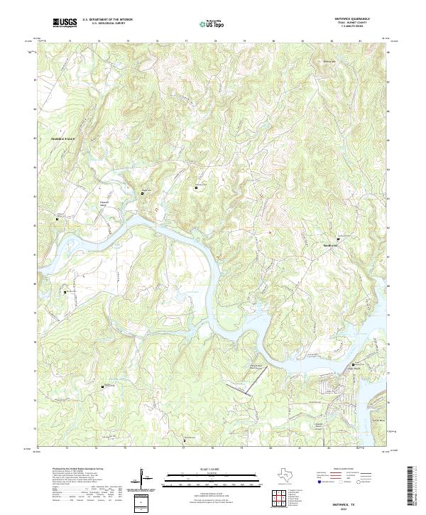
2022 Map of Smithwick
USGS Topo · Published 2022About this map
The Colorado River and the upper reaches of Lake Travis define this Burnet County landscape, where the water cuts through high ground marked by Hatchett Hill and Wildcat Mtn. This area near Marble Falls maintains a largely rural character, with residential clusters at Smithwick and Eagle Bluffs positioned along the river bends. The map reveals a high concentration of small family and community burial grounds, including the Burnam - Smithwick Cem, Pangle Cem, and Richland Cem, which offer significant value for genealogists tracing local pioneers.
Find a feature on this map
87 named features on this map. Tap any name to fly to it.
Don’t see what you’re looking for? This feature index may not catch every label — zoom into the map to look around manually.
Map Details
Editions of this 2022 Smithwick Map
This is the sole edition of this map. No revisions or reprints were ever made.
Other maps of this area

1887 · Blanco
USGS Topo · 1:125,000

1887 · Burnet
USGS Topo · 1:125,000

1893 · Burnet
USGS Topo · 1:125,000

1894 · Blanco
USGS Topo · 1:125,000

1903 · Burnet
USGS Topo · 1:125,000

1909 · Burnet
USGS Topo · 1:125,000

1925 · Burnet 3-d
USGS Topo · 1:48,000

1929 · Marble Falls
USGS Topo · 1:62,500

1930 · Blanco-1
USGS Topo · 1:48,000

1932 · Marble Falls
USGS Topo · 1:62,500