
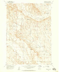
1951 Map of Smithwick NE
USGS Topo · Published 1953About this map
The Cheyenne River cuts across the northwest corner of this 1951 survey, defining the lower reaches of the Black Hills foothills. This landscape is characterized by its prominent upland plateaus and deep drainage systems, most notably the Squaw-Humper Table and the extensive Pine Ridge Indian Reservation Boundary along the eastern edge. Settlement is sparse, focused around the small community of Smithwick in the southwest, while the remainder of the territory is a network of named canyons and flats. Local topography is deeply etched by watercourses such as Jim Wilson Canyon and First Black Canyon, which drain the elevated benches of Harrison Flat and Wagon Flat. The map reflects a mid-century period of land management and Missouri River Basin development, captured just as aerial photography began to provide precise detail of these complex South Dakota landforms.
Find a feature on this map
13 named features on this map. Tap any name to fly to it.
Don’t see what you’re looking for? This feature index may not catch every label — zoom into the map to look around manually.
Map Details
Editions of this 1951 Smithwick NE Map
This is the sole edition of this map. No revisions or reprints were ever made.
Other maps of this area

1894 · Hermosa
USGS Topo · 1:125,000

1896 · Oelrichs
USGS Topo · 1:125,000

1900 · Oelrichs
USGS Topo · 1:125,000

1901 · Hermosa
USGS Topo · 1:125,000

1951 · Fairburn SE
USGS Topo · 1:24,000

1951 · Willow Creek NW
USGS Topo · 1:24,000

1951 · Red Shirt SW
USGS Topo · 1:24,000

1951 · Smithwick NW
USGS Topo · 1:24,000

1955 · Hot Springs
USGS Topo · 1:250,000
1957 · Fairburn SW
USGS Topo · 1:24,000