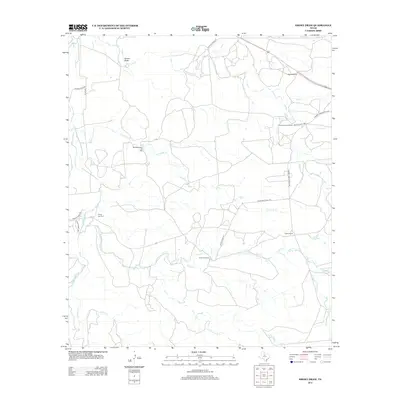
2012 Map of Smoky Draw
USGS Topo · Published 2012About this map
Smoky Draw characterizes this stretch of West Texas ranch land, where the landscape is defined by its drainage networks and petroleum production. The Matilda Perkins Oil Field serves as a focal point for local industry, while several established ranch properties, including Bud Matthews, Chimney Creek Ranch, and Buck Nail Ranch, illustrate the region's enduring agricultural layout. These large landholdings are connected by a network of private roads, such as Private Road 2210 and Chimney Creek Ranch Rd, reflecting the private nature of the contemporary rural infrastructure.
Find a feature on this map
22 named features on this map. Tap any name to fly to it.
Don’t see what you’re looking for? This feature index may not catch every label — zoom into the map to look around manually.
Map Details
Editions of this 2012 Smoky Draw Map
This is the sole edition of this map. No revisions or reprints were ever made.
Other maps of this area

1891 · Anson
USGS Topo · 1:125,000

1892 · Albany
USGS Topo · 1:125,000

1893 · Albany
USGS Topo · 1:125,000

1893 · Anson
USGS Topo · 1:125,000

1954 · Abilene
USGS Topo · 1:250,000

1957 · Nugent
USGS Topo · 1:62,500
1957 · Hamby
USGS Topo · 1:24,000

1958 · Abilene
USGS Topo · 1:250,000

1965 · Acampo
USGS Topo · 1:24,000

1965 · Lueders West
USGS Topo · 1:24,000