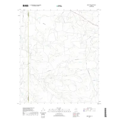
2019 Map of Smoky Draw
USGS Topo · Published 2019About this map
Rising Sun Cem sits at the heart of this rangeland landscape along the dividing line between Jones and Shackelford counties. The terrain is defined by a dense network of intermittent watercourses that carve through the Texas brush country, including the namesake Smoky Draw and the various branches of Threemile Cr. Modern land use is signaled by sprawling ranch properties, evidenced by private access routes like Buck Nail Ranch Rd and Chimney Creek Ranch Rd. These large tracts preserve a sense of the open country that has characterized this region for generations, where cattle ranching remains a primary influence on the landscape. The drainage patterns of Deadman Creek and Long Cr illustrate the hydrological character of the Rolling Plains, where water is a seasonal but powerful force in shaping the local topography.
Find a feature on this map
14 named features on this map. Tap any name to fly to it.
Don’t see what you’re looking for? This feature index may not catch every label — zoom into the map to look around manually.
Map Details
Editions of this 2019 Smoky Draw Map
This is the sole edition of this map. No revisions or reprints were ever made.
Other maps of this area

1891 · Anson
USGS Topo · 1:125,000

1892 · Albany
USGS Topo · 1:125,000

1893 · Albany
USGS Topo · 1:125,000

1893 · Anson
USGS Topo · 1:125,000

1954 · Abilene
USGS Topo · 1:250,000

1957 · Nugent
USGS Topo · 1:62,500
1957 · Hamby
USGS Topo · 1:24,000

1958 · Abilene
USGS Topo · 1:250,000

1965 · Acampo
USGS Topo · 1:24,000

1965 · Lueders West
USGS Topo · 1:24,000