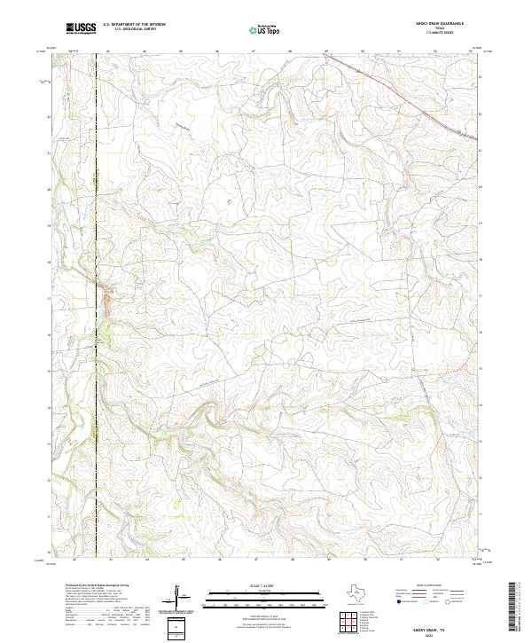
2022 Map of Smoky Draw
USGS Topo · Published 2022About this map
The Jones and Shackelford county line divides this landscape of winding draws and ranch roads in West Texas. This modern survey illustrates a rural terrain defined by complex drainage systems, where Smoky Draw and Deadman Creek carve through the cattle country of the Rolling Plains. The infrastructure is characterized by long private access ways and ranching arteries like Buck Nail Ranch Rd and Chimney Creek Ranch Rd, reflecting the large-scale landholdings of the region. Local history and genealogy interest is anchored by the Rising Sun Cem, a solitary landmark situated near the western boundary. The map captures a topography where water is the primary architect, with Threemile Cr, Long Cr, and Chimney Cr creating a dense network of seasonal creek beds and forks.
Find a feature on this map
17 named features on this map. Tap any name to fly to it.
Don’t see what you’re looking for? This feature index may not catch every label — zoom into the map to look around manually.
Map Details
Editions of this 2022 Smoky Draw Map
This is the sole edition of this map. No revisions or reprints were ever made.
Other maps of this area

1891 · Anson
USGS Topo · 1:125,000

1892 · Albany
USGS Topo · 1:125,000

1893 · Albany
USGS Topo · 1:125,000

1893 · Anson
USGS Topo · 1:125,000

1954 · Abilene
USGS Topo · 1:250,000

1957 · Nugent
USGS Topo · 1:62,500
1957 · Hamby
USGS Topo · 1:24,000

1958 · Abilene
USGS Topo · 1:250,000

1965 · Acampo
USGS Topo · 1:24,000

1965 · Lueders West
USGS Topo · 1:24,000