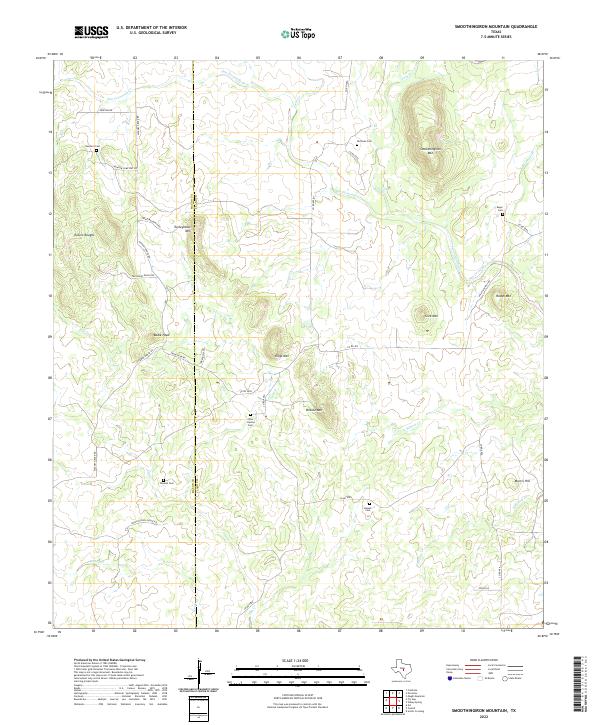
2022 Map of Smoothingiron Mountain
USGS Topo · Published 2022About this map
Smoothingiron Mtn and its surrounding peaks define this cattle country landscape on the border of Mason and Llano counties. The terrain is marked by high points including Turkeyroost Mtn, Kings Mtn, and Briscoe Mtn, with the drainage of San Fernando Cr and Cold Cr cutting through the granite uplift. For the local historian and genealogist, the map is remarkably dense with family-named landmarks and cemeteries, including the Chew - Harlow Cem and Huffman Cem. The road network, featuring names like Union School House Rd and Newsom Cemetery Rd, hints at the former community centers of this ranching region. Isolated peaks like Bodie Peak and the rough country of Eckert Roughs provide clear markers for navigating this corner of the Texas Hill Country.
Find a feature on this map
41 named features on this map. Tap any name to fly to it.
Don’t see what you’re looking for? This feature index may not catch every label — zoom into the map to look around manually.
Map Details
Editions of this 2022 Smoothingiron Mountain Map
This is the sole edition of this map. No revisions or reprints were ever made.
Other maps of this area

1887 · Llano
USGS Topo · 1:125,000

1887 · Mason
USGS Topo · 1:125,000

1894 · Mason
USGS Topo · 1:125,000

1894 · Llano
USGS Topo · 1:125,000

1904 · Llano
USGS Topo · 1:125,000

1909 · Llano
USGS Topo · 1:125,000

1918 · Llano
USGS Topo · 1:125,000

1954 · Llano
USGS Topo · 1:250,000

1955 · Llano
USGS Topo · 1:250,000
1955 · Magill Mountain
USGS Topo · 1:24,000