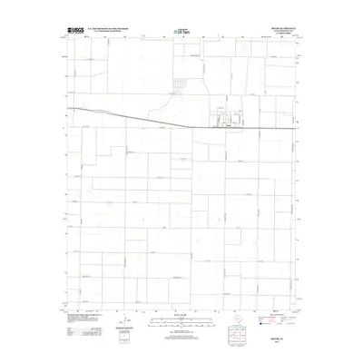
2012 Map of Smyer
USGS Topo · Published 2012About this map
Smyer serves as the primary hub of this High Plains landscape, organized by a rigid grid of agricultural roads that define the rural character of Hockley County. The town center is structured around a traditional street plan featuring Buchanan St, Garfield St, and McKinley St, situated just north of the east-west corridor of Cactus Dr. The surrounding terrain is a patchwork of large-scale ranching and farming operations, evidenced by labels like Spade Farms Rd and the extensive network of livestock-themed thoroughfares such as Bear Rd and Coyote Rd.
Find a feature on this map
37 named features on this map. Tap any name to fly to it.
Don’t see what you’re looking for? This feature index may not catch every label — zoom into the map to look around manually.
Map Details
Editions of this 2012 Smyer Map
This is the sole edition of this map. No revisions or reprints were ever made.
Other maps of this area

1954 · Brownfield
USGS Topo · 1:250,000

1957 · Meadow
USGS Topo · 1:62,500

1957 · Wolfforth
USGS Topo · 1:62,500

1958 · Brownfield
USGS Topo · 1:250,000

1962 · Brownfield
USGS Topo · 1:250,000

1964 · Whitharral
USGS Topo · 1:24,000

1965 · Levelland East
USGS Topo · 1:24,000

1965 · Lockettville
USGS Topo · 1:24,000
1976 · Wolfforth NW
USGS Topo · 1:24,000

1976 · Wolfforth SE
USGS Topo · 1:24,000