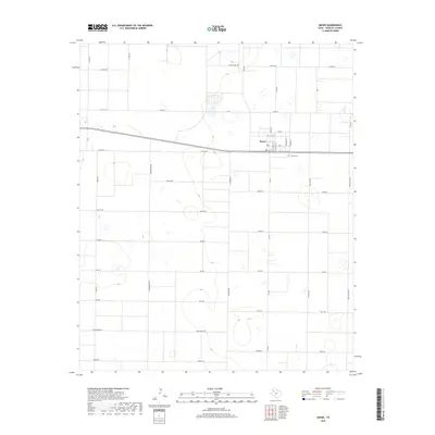
2019 Map of Smyer
USGS Topo · Published 2019About this map
The town of Smyer serves as the focal point of this High Plains landscape, organized around a rigid grid of ranch roads and thoroughfares. Located in Hockley County, the settlement is anchored by a Po and the nearby Smyer Cem to the east. The surrounding territory is defined by large-scale agricultural and ranching divisions, with roads named for native fauna such as Coyote Rd, Deer Rd, Elk Rd, and Bear Rd. Major transit is facilitated by Fm 168, which bisects the quadrangle from north to south. Notable agrarian landmarks like Spade Farms Rd in the north suggest the region's enduring cattle and farming heritage, while the density of named residential streets in the town site, including Cleveland St and Kennedy St, reflects its local significance as a rural hub.
Find a feature on this map
36 named features on this map. Tap any name to fly to it.
Don’t see what you’re looking for? This feature index may not catch every label — zoom into the map to look around manually.
Map Details
Editions of this 2019 Smyer Map
This is the sole edition of this map. No revisions or reprints were ever made.
Other maps of this area

1954 · Brownfield
USGS Topo · 1:250,000

1957 · Meadow
USGS Topo · 1:62,500

1957 · Wolfforth
USGS Topo · 1:62,500

1958 · Brownfield
USGS Topo · 1:250,000

1962 · Brownfield
USGS Topo · 1:250,000

1964 · Whitharral
USGS Topo · 1:24,000

1965 · Levelland East
USGS Topo · 1:24,000

1965 · Lockettville
USGS Topo · 1:24,000
1976 · Wolfforth NW
USGS Topo · 1:24,000

1976 · Wolfforth SE
USGS Topo · 1:24,000