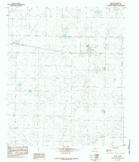
1985 Map of Smyer
USGS Topo · Published 1985About this map
Smyer stands as the primary hub of this High Plains landscape in the mid-1980s, where the rectilinear grid of Texas county roads meets a complex network of resource extraction. The area is defined by an extensive concentration of Well sites and a prominent Pipeline network, illustrating the intensive petroleum or water development typical of Hockley County. Outside the town center, a localized Trailer Park and an Athletic Field reflect the community's domestic and social footprint during this era.
Find a feature on this map
10 named features on this map. Tap any name to fly to it.
Don’t see what you’re looking for? This feature index may not catch every label — zoom into the map to look around manually.
Map Details
Editions of this 1985 Smyer Map
This is the sole edition of this map. No revisions or reprints were ever made.
Other maps of this area

1954 · Brownfield
USGS Topo · 1:250,000

1957 · Meadow
USGS Topo · 1:62,500

1957 · Wolfforth
USGS Topo · 1:62,500

1958 · Brownfield
USGS Topo · 1:250,000

1962 · Brownfield
USGS Topo · 1:250,000

1964 · Whitharral
USGS Topo · 1:24,000

1965 · Levelland East
USGS Topo · 1:24,000

1965 · Lockettville
USGS Topo · 1:24,000
1976 · Wolfforth NW
USGS Topo · 1:24,000

1976 · Wolfforth SE
USGS Topo · 1:24,000