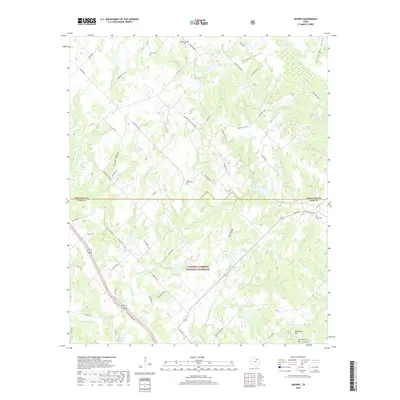
2019 Map of Smyrna
USGS Topo · Published 2019About this map
The Lyndon B. Johnson National Grassland dominates the central and southern portions of this landscape along the border of Montague and Wise Counties. This protected acreage preserves a complex network of drainages including Grapevine Creek, Cattail Hollow, and Dry Hollow. Genealogists and local historians will find several well-preserved rural burial sites such as Huddleston Cemetery in the north and Ball Knob Cemetery near the base of Ball Knob Hill in the southeast.
Find a feature on this map
63 named features on this map. Tap any name to fly to it.
Don’t see what you’re looking for? This feature index may not catch every label — zoom into the map to look around manually.
Map Details
Editions of this 2019 Smyrna Map
This is the sole edition of this map. No revisions or reprints were ever made.
Other maps of this area

1905 · Montague
USGS Topo · 1:125,000

1954 · Sherman
USGS Topo · 1:250,000

1958 · Sherman
USGS Topo · 1:250,000

1961 · Pecan Creek
USGS Topo · 1:24,000

1961 · Salona
USGS Topo · 1:24,000

1961 · Alvord
USGS Topo · 1:24,000

1961 · New Harp
USGS Topo · 1:24,000

1961 · Sunset
USGS Topo · 1:24,000
1961 · Smyrna
USGS Topo · 1:24,000

1961 · Bowie
USGS Topo · 1:24,000