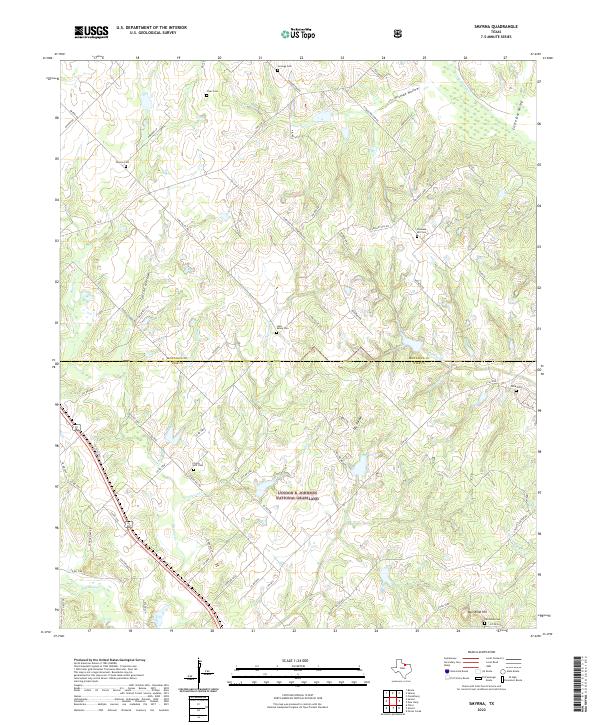
2022 Map of Smyrna
USGS Topo · Published 2022About this map
The Lyndon B. Johnson National Grassland dominates the southern portion of this landscape along the border of Montague and Wise Counties. This area is characterized by a high density of small rural burial grounds, including Smyrna Cem, Union Hill Cem, and Lake Valley Cem, suggesting a long-established network of family farms and early communities. The terrain is deeply carved by drainage systems like Cattail Hollow, Pitman Hollow, and Little Dry Valley, which feed into larger watercourses such as Denton Cr and Big Sandy Cr. Local travel follows a mesh of numbered county roads and private lanes like Pleasant Hill Cemetery Rd and Huddleston Rd, connecting the scattered hillsides and creek bottoms. The presence of Ball Knob Hill near the southern boundary provides a distinct high point in an otherwise undulating landscape of pastures and wooded draws.
Find a feature on this map
73 named features on this map. Tap any name to fly to it.
Don’t see what you’re looking for? This feature index may not catch every label — zoom into the map to look around manually.
Map Details
Editions of this 2022 Smyrna Map
This is the sole edition of this map. No revisions or reprints were ever made.
Other maps of this area

1905 · Montague
USGS Topo · 1:125,000

1954 · Sherman
USGS Topo · 1:250,000

1958 · Sherman
USGS Topo · 1:250,000

1961 · Pecan Creek
USGS Topo · 1:24,000

1961 · Salona
USGS Topo · 1:24,000

1961 · Alvord
USGS Topo · 1:24,000

1961 · New Harp
USGS Topo · 1:24,000

1961 · Sunset
USGS Topo · 1:24,000
1961 · Smyrna
USGS Topo · 1:24,000

1961 · Bowie
USGS Topo · 1:24,000