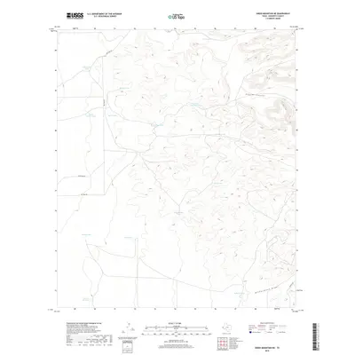
2019 Map of Sneed Mountain NE
USGS Topo · Published 2019About this map
Apache Canyon cuts through the high desert of Hudspeth County, serving as a primary drainage in a landscape defined by its network of water catchment systems. In this arid reach of West Texas, the presence of numerous named water tanks—such as Uncle Sammy Tank, Schuessler Tank, and Rock Bottom Tank—underscores the vital importance of seasonal water management for ranching and livestock operations. The distribution of these tanks, often found at the base of significant slopes or within ephemeral watercourses like Witherspoon Draw, suggests a long-standing pattern of land use focused on harvesting every drop of desert runoff.
Find a feature on this map
19 named features on this map. Tap any name to fly to it.
Don’t see what you’re looking for? This feature index may not catch every label — zoom into the map to look around manually.
Map Details
Editions of this 2019 Sneed Mountain NE Map
This is the sole edition of this map. No revisions or reprints were ever made.
Other maps of this area

1895 · Sierra Blanca
USGS Topo · 1:125,000

1906 · Van Horn
USGS Topo · 1:125,000

1954 · Van Horn
USGS Topo · 1:250,000

1955 · Black Mountains
USGS Topo · 1:62,500

1958 · Van Horn
USGS Topo · 1:250,000

1973 · Norton Mesa
USGS Topo · 1:24,000

1973 · Bitter Well Mountain SW
USGS Topo · 1:24,000

1973 · Sneed Mountain NE
USGS Topo · 1:24,000

1973 · Apache Peak
USGS Topo · 1:24,000
1973 · Sneed Mountain
USGS Topo · 1:24,000