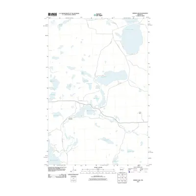
2010 Map of Snider Lake
USGS Topo · Published 2010About this map
Glacial lake basins and interconnected waterways dominate this portion of the White Earth Reservation in Becker County. Snider Lake and Wadena Lake are central features in a complex landscape where small, named water bodies like Nest Lake, Rooster Lake, and Mike Lake are linked by seasonal drainages. The local infrastructure is shaped by this water-rich environment, as seen at the McCraney Lake Dam and the winding course of Little Elbow Creek as it moves toward the east.
Find a feature on this map
43 named features on this map. Tap any name to fly to it.
Don’t see what you’re looking for? This feature index may not catch every label — zoom into the map to look around manually.
Map Details
Editions of this 2010 Snider Lake Map
This is the sole edition of this map. No revisions or reprints were ever made.
Other maps of this area

1954 · Bemidji
USGS Topo · 1:250,000

1957 · Bemidji
USGS Topo · 1:250,000

1958 · Bemidji
USGS Topo · 1:250,000

1969 · North Twin Lake
USGS Topo · 1:24,000

1969 · Many Point Lake
USGS Topo · 1:24,000

1969 · Roy Lake
USGS Topo · 1:24,000

1969 · Tulaby Lake
USGS Topo · 1:24,000
1969 · Ogema NE
USGS Topo · 1:24,000
1969 · Strawberry Lake
USGS Topo · 1:24,000

1969 · Snider Lake
USGS Topo · 1:24,000