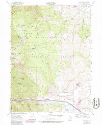
1955 Map of Snow Basin
USGS Topo · Published 1986About this map
Snow Basin Ski Area occupies the western high ground of this survey, featuring landmarks like the Ski Jump, Shelter, and various alpine bowls including Easter Bowl and Strawberry Bowl. The landscape descends from the heights of Mt Ogden Bowl and De Moisy Peak into the canyon and valley systems below. In the southern portion, the Weber River and the Union Pacific railroad navigate the tight corridor of Weber Canyon, passing the narrow gap at Devils Gate.
Find a feature on this map
63 named features on this map. Tap any name to fly to it.
Don’t see what you’re looking for? This feature index may not catch every label — zoom into the map to look around manually.
Map Details
Editions of this 1955 Snow Basin Map
3 editions found
Other maps of this area

1954 · Ogden
USGS Topo · 1:250,000

1955 · Ogden
USGS Topo · 1:24,000

1955 · Peterson
USGS Topo · 1:24,000

1955 · Huntsville
USGS Topo · 1:24,000

1955 · North Ogden
USGS Topo · 1:24,000

1955 · Kaysville
USGS Topo · 1:24,000

1955 · Snow Basin
USGS Topo · 1:24,000

1958 · Ogden
USGS Topo · 1:250,000

1960 · Ogden
USGS Topo · 1:250,000
1961 · Morgan
USGS Topo · 1:24,000