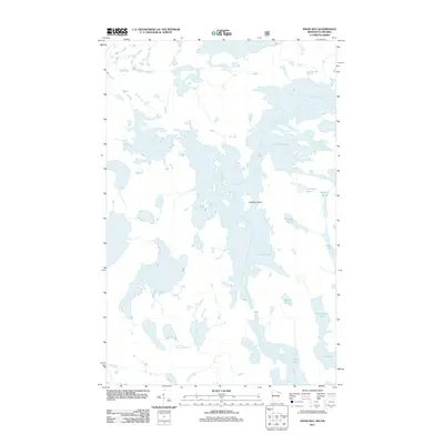
2011 Map of Snow Bay
USGS Topo · Published 2011About this map
Lac la Croix dominates this borderland geography, weaving between a dense network of smaller interior water bodies and islands. The 2011 survey reveals an intricate aquatic landscape where Sandbar Island and dozens of unnamed landforms fragment the larger expanse of the lake. Smaller, isolated basins like Auchagah Lake, Section Pond, and Norway Lake are tucked into the shoreline, illustrating the complex drainage patterns of the Rainy River District. To the south, the terrain transitions toward Loon Lake and Little Loon Lake, separated by narrow channels and land bridges. This map captures the region's wilderness character, where the absence of roads and settlements emphasizes a landscape shaped almost entirely by glacial activity and water levels.
Find a feature on this map
9 named features on this map. Tap any name to fly to it.
Don’t see what you’re looking for? This feature index may not catch every label — zoom into the map to look around manually.
Map Details
Editions of this 2011 Snow Bay Map
This is the sole edition of this map. No revisions or reprints were ever made.
Other maps of this area

1954 · International Falls
USGS Topo · 1:250,000

1957 · International Falls
USGS Topo · 1:250,000

1958 · International Falls
USGS Topo · 1:250,000

1963 · Echo Lake
USGS Topo · 1:24,000

1963 · Takucmich Lake
USGS Topo · 1:24,000

1963 · Snow Bay
USGS Topo · 1:24,000

1963 · Redhorse Bay
USGS Topo · 1:24,000

1963 · Lake Jeanette
USGS Topo · 1:24,000

1963 · Crane Lake
USGS Topo · 1:24,000
1963 · Shell Lake
USGS Topo · 1:24,000