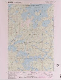
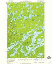
1981 Map of Snowbank Lake
USGS Topo · Published 1986About this map
Boundary Waters Canoe Area Wilderness defines this landscape of interconnected waterways and protected forests in northern Minnesota. This 1980s revision reveals the intricate network of portages and islands that characterize Snowbank Lake, including Wilderness Bay and Three Sisters Islands. The map provides a detailed view of the transition between road-accessible points like the Boy Scout Camp on Moose Lake and the interior wilderness accessible only by water or trail.
Find a feature on this map
58 named features on this map. Tap any name to fly to it.
Don’t see what you’re looking for? This feature index may not catch every label — zoom into the map to look around manually.
Map Details
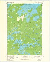
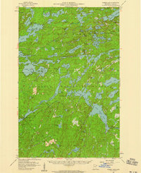
Editions of this 1981 Snowbank Lake Map
3 editions found

Other maps of this area

1954 · Two Harbors
USGS Topo · 1:250,000

1957 · Two Harbors
USGS Topo · 1:250,000
1957 · Gabbro Lake
USGS Topo · 1:62,500
1957 · Ensign Lake
USGS Topo · 1:62,500
1957 · Basswood Lake
USGS Topo · 1:62,500
1957 · Quetico
USGS Topo · 1:250,000

1958 · Two Harbors
USGS Topo · 1:250,000

1964 · Two Harbors
USGS Topo · 1:250,000

1968 · Quetico
USGS Topo · 1:250,000

1976 · Basswood Lake SE
USGS Topo · 1:24,000