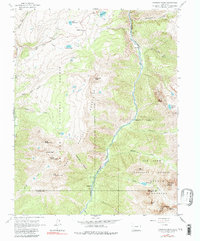
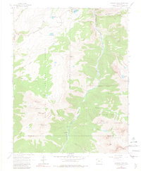
1964 Map of Snowdon Peak
USGS Topo · Published 1984About this map
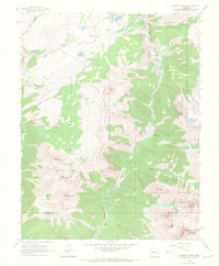
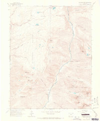
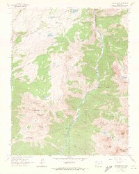
The Denver and Rio Grande Western Railroad follows the steep canyon of the Animas River, a vital transportation corridor through the high-altitude terrain of the San Juan National Forest. Small mountain settlements like Needleton and Elk Park serve as key stops along this narrow-gauge line, with the Needleton Water Tank providing a necessary service point for steam locomotives within Watertank Canyon. To the west, the landscape is defined by the Needle Mountains, while the Grenadier Range rises to the east, anchored by prominent summits such as Mount Garfield and Snowdon Peak.
Find a feature on this map
48 named features on this map. Tap any name to fly to it.
Don’t see what you’re looking for? This feature index may not catch every label — zoom into the map to look around manually.
Map Details
Editions of this 1964 Snowdon Peak Map
5 editions found
Other maps of this area

1897 · Telluride
USGS Topo · 1:62,500

1897 · Silverton
USGS Topo · 1:62,500

1898 · Engineer Mountain
USGS Topo · 1:62,500

1900 · Engineer Mountain
USGS Topo · 1:62,500

1900 · Needle Mountains
USGS Topo · 1:62,500

1901 · Silverton
USGS Topo · 1:62,500

1902 · Needle Mountains
USGS Topo · 1:62,500

1902 · Silverton
USGS Topo · 1:62,500

1904 · Telluride
USGS Topo · 1:62,500
1908 · Engineer Mountain
USGS Topo · 1:62,500