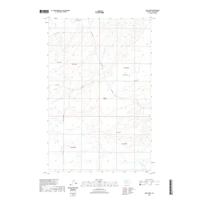
2020 Map of Soap Creek
USGS Topo · Published 2020About this map
Spring Hill and Porter Bench rise above a landscape defined by an intricate network of drainages and ranch roads in this portion of Teton County. The hydrology is dominated by the Soap Cr and the S Fork Dry Fork Marias River, which carve through the terrain alongside numerous coulees like Farmers Coulee, Bills Coulee, and Jensen Coulee. This high-plains environment is mapped with modern precision, showing the established section lines of T27N and T26N. Local transit is facilitated by a grid of rural routes including W Pendroy Rd, Halverson Rd, and N Gypsy Basin Rd. The prevalence of small watercourses such as Jones Cr and Spring Cr indicates a landscape shaped by seasonal runoff, essential for the remote ranching and agricultural operations of the region.
Find a feature on this map
20 named features on this map. Tap any name to fly to it.
Don’t see what you’re looking for? This feature index may not catch every label — zoom into the map to look around manually.
Map Details
Editions of this 2020 Soap Creek Map
This is the sole edition of this map. No revisions or reprints were ever made.
Other maps of this area

1903 · Saypo
USGS Topo · 1:125,000

1914 · Heart Butte
USGS Topo · 1:125,000

1918 · Heart Butte
USGS Topo · 1:125,000

1920 · Choteau
USGS Topo · 1:125,000

1920 · Dupuyer
USGS Topo · 1:125,000

1936 · Pendroy
USGS Topo · 1:48,000

1941 · Pendroy
USGS Topo · 1:62,500

1955 · Choteau
USGS Topo · 1:250,000

1957 · Choteau
USGS Topo · 1:250,000

1958 · Choteau
USGS Topo · 1:250,000