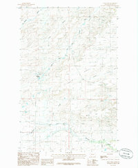
1985 Map of Soap Creek
USGS Topo · Published 1986About this map
Rockport Colony stands as a primary focal point in this 1980s landscape of Teton County, situated on the edge of the expansive Porter Bench. The terrain is defined by the incision of watercourses like the Dry Fork Marias River and its various tributaries, including the South Fork and Soap Creek, which carve through the plains. The presence of the Bynum Canal in the southeastern corner indicates the critical role of irrigation and water management for agriculture in this region of Montana.
Find a feature on this map
15 named features on this map. Tap any name to fly to it.
Don’t see what you’re looking for? This feature index may not catch every label — zoom into the map to look around manually.
Map Details
Editions of this 1985 Soap Creek Map
This is the sole edition of this map. No revisions or reprints were ever made.
Other maps of this area

1903 · Saypo
USGS Topo · 1:125,000

1914 · Heart Butte
USGS Topo · 1:125,000

1918 · Heart Butte
USGS Topo · 1:125,000

1920 · Choteau
USGS Topo · 1:125,000

1920 · Dupuyer
USGS Topo · 1:125,000

1936 · Pendroy
USGS Topo · 1:48,000

1941 · Pendroy
USGS Topo · 1:62,500

1955 · Choteau
USGS Topo · 1:250,000

1957 · Choteau
USGS Topo · 1:250,000

1958 · Choteau
USGS Topo · 1:250,000