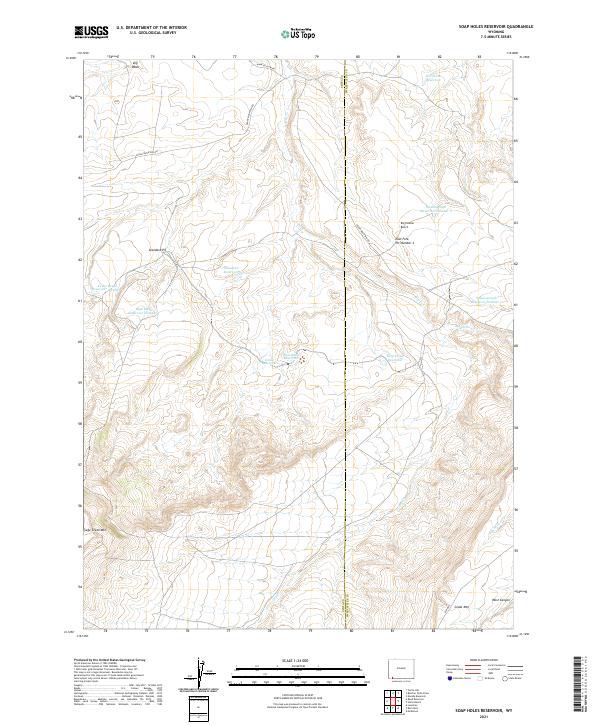
2021 Map of Soap Holes Reservoir
USGS Topo · Published 2021About this map
The high-desert terrain of the Wyoming-Utah border region is defined by complex water management and extractive industry on this 2021 survey. Spanning the Uinta Co Sweetwater Co line, the landscape is marked by numerous artificial water bodies including Soap Holes Reservoir, Hordeum Reservoir, and several numbered basins like Seismograph Reservoir Number 2. These features, along with names like Dry Cr and Dry Wash, reflect the arid nature of the high country between the peaks of Sage Creek Mtn and Cedar Mtn. Human activity is concentrated along the dirt tracks of Hank Hollow Rd and Cedar Mountain Rd, leading to industrial sites such as Standard Pit and the East Fork Pit Number 1. The map captures a moment in the modern West where ranching infrastructure and resource extraction meet on the expansive Big Hollow Bench.
Find a feature on this map
28 named features on this map. Tap any name to fly to it.
Don’t see what you’re looking for? This feature index may not catch every label — zoom into the map to look around manually.
Map Details
Editions of this 2021 Soap Holes Reservoir Map
This is the sole edition of this map. No revisions or reprints were ever made.
Other maps of this area

1954 · Ogden
USGS Topo · 1:250,000

1954 · Rock Springs
USGS Topo · 1:250,000

1958 · Ogden
USGS Topo · 1:250,000

1958 · Rock Springs
USGS Topo · 1:250,000

1960 · Ogden
USGS Topo · 1:250,000

1962 · Rock Springs
USGS Topo · 1:250,000

1964 · Butcher Knife Draw
USGS Topo · 1:24,000
1964 · Mc Kinnon
USGS Topo · 1:24,000

1964 · Soap Holes Reservoir
USGS Topo · 1:24,000

1964 · Reed Reservoir
USGS Topo · 1:24,000