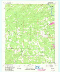
1962 Map of Sobol
USGS Topo · Published 1993About this map
Sobol and North Sobol sit at the center of this 1960s landscape, which spans the borders of Pushmataha, Choctaw, and McCurtain counties. The terrain is defined by a dense network of waterways, including Turkey Creek, Rock Creek, and Rain Creek, all feeding toward the Little River. The 1993 revision highlights the emergence of Pine Creek Lake and Pine Creek State Park, which altered the local geography as parts of the river valley were inundated.
Find a feature on this map
29 named features on this map. Tap any name to fly to it.
Don’t see what you’re looking for? This feature index may not catch every label — zoom into the map to look around manually.
Map Details
Editions of this 1962 Sobol Map
3 editions found
Other maps of this area

1901 · Alikchi
USGS Topo · 1:125,000

1950 · Mcalester
USGS Topo · 1:250,000

1962 · McAlester
USGS Topo · 1:250,000

1962 · Wright City
USGS Topo · 1:24,000

1962 · Sobol
USGS Topo · 1:24,000

1962 · Caney Mountain
USGS Topo · 1:24,000

1962 · Alikchi
USGS Topo · 1:24,000

1962 · Signal Mountain
USGS Topo · 1:24,000
1962 · Swink
USGS Topo · 1:24,000

1965 · McAlester
USGS Topo · 1:250,000