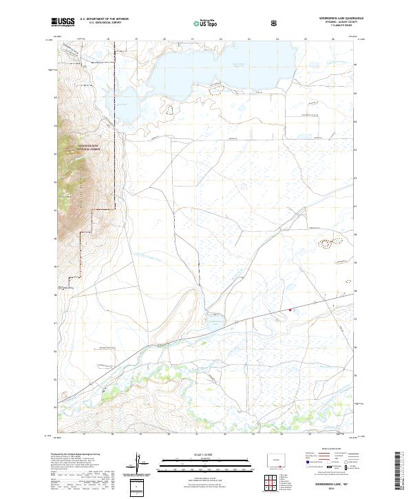
2021 Map of Sodergreen Lake
USGS Topo · Published 2021About this map
The eastern slopes of the Medicine Bow Mountains descend toward a complex network of water management features in Albany County. The landscape is defined by the massive Lake Hattie Reservoir and the smaller Sodergreen Lake, which serve as hubs for an extensive system of irrigation and transport. A web of man-made waterways, including the Lake Hattie Supply Canal, Pioneer Canal, and multiple numbered ditches like Riverside Ditch Number 1, reflects the area's intensive ranching and agricultural development. The Laramie River winds through the southern portion of the sheet, flanked by family-named infrastructure and local landmarks such as Sheep Mtn and Moonshine Gulch. The map also captures the edge of the Medicine Bow National Forest, illustrating the boundary where protected wilderness meets the high-plains water economy.
Find a feature on this map
45 named features on this map. Tap any name to fly to it.
Don’t see what you’re looking for? This feature index may not catch every label — zoom into the map to look around manually.
Map Details
Editions of this 2021 Sodergreen Lake Map
This is the sole edition of this map. No revisions or reprints were ever made.
Other maps of this area

1895 · Laramie
USGS Topo · 1:125,000

1902 · Laramie
USGS Topo · 1:125,000

1905 · Laramie
USGS Topo · 1:125,000

1906 · Medicine Bow
USGS Topo · 1:125,000

1906 · Laramie
USGS Topo · 1:125,000

1908 · Laramie
USGS Topo · 1:125,000

1908 · Medicine Bow
USGS Topo · 1:125,000

1954 · Cheyenne
USGS Topo · 1:250,000

1954 · Rawlins
USGS Topo · 1:250,000

1958 · Rawlins
USGS Topo · 1:250,000