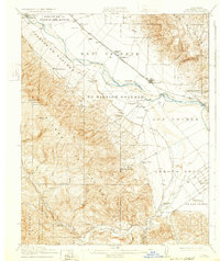
1915 Map of Soledad
USGS Topo · Published 1932About this map
Mission Soledad (Ruins) stands near the center of this Salinas Valley landscape, marking the historic center of the Ex Mission Soledad land grant. The agricultural development of the early twentieth century is evident in the network of pump houses and canals feeding the lands between the Salinas River and the Arroyo Seco. Along the Southern Pacific railroad line, smaller settlements like Molus, Camphora, and the primary hub of Soledad support the region's cattle and farming interests. To the west, the terrain rises sharply into the Sierra de Salinas and the Monterey National Forest. This survey also documents local community life through a series of rural schoolhouses, including the Soberanes School, Fairview School, and Fort Romie School, alongside recreational sites like the Rio Alto Gun Club and the medicinal retreat at Paraiso Springs.
Find a feature on this map
39 named features on this map. Tap any name to fly to it.
Don’t see what you’re looking for? This feature index may not catch every label — zoom into the map to look around manually.
Map Details
Editions of this 1915 Soledad Map
4 editions found
Other maps of this area

1910 · Gonzales
USGS Topo · 1:31,680

1910 · Salinas
USGS Topo · 1:31,680

1910 · Soledad
USGS Topo · 1:31,680

1912 · Salinas
USGS Topo · 1:62,500

1912 · Metz
USGS Topo · 1:31,680

1915 · Soledad
USGS Topo · 1:62,500

1919 · King City
USGS Topo · 1:62,500

1919 · San Benito
USGS Topo · 1:62,500

1919 · Junipero Serra
USGS Topo · 1:62,500

1920 · Jamesburg
USGS Topo · 1:48,000