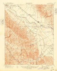
1915 Map of Soledad
USGS Topo · Published 1948About this map
Mission Soledad (Ruins) sits as a quiet landmark at the heart of the Salinas Valley in this 1910s survey, representing the historical Spanish influence in the region long after the secularization of the missions. The landscape is defined by the sharp contrast between the irrigated valley floor and the rising slopes of the Sierra de Salinas. Along the Southern Pacific rail line, small agricultural outposts and schools such as Camphora School and Fairview School serve a developing rural community.
Find a feature on this map
36 named features on this map. Tap any name to fly to it.
Don’t see what you’re looking for? This feature index may not catch every label — zoom into the map to look around manually.
Map Details
Editions of this 1915 Soledad Map
4 editions found
Other maps of this area

1910 · Gonzales
USGS Topo · 1:31,680

1910 · Salinas
USGS Topo · 1:31,680

1910 · Soledad
USGS Topo · 1:31,680

1912 · Salinas
USGS Topo · 1:62,500

1912 · Metz
USGS Topo · 1:31,680

1915 · Soledad
USGS Topo · 1:62,500

1919 · King City
USGS Topo · 1:62,500

1919 · San Benito
USGS Topo · 1:62,500

1919 · Junipero Serra
USGS Topo · 1:62,500

1920 · Jamesburg
USGS Topo · 1:48,000