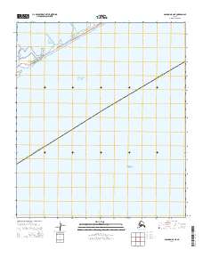
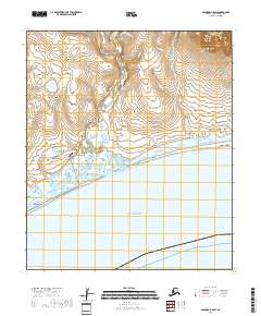
2014 Map of Solomon B-6 NE
USGS Topo · Published 2014About this map
Council Road skirts the narrow shoreline between the lagoon waters of Safety Sound and the open expanse of Norton Sound in this coastal Alaskan landscape. This 2014 survey documents the transitional maritime environment where the Seward Peninsula meets the Bering Sea. The map highlights the sparse infrastructure of the Alaska Nome Census Area, focusing on the thin strip of land that carries the vital roadway along the coast. The absence of inland development and the prominence of coastal hydrology define the character of this remote subarctic region, illustrating how geography dictates transport patterns in the far north.
Find a feature on this map
8 named features on this map. Tap any name to fly to it.
Don’t see what you’re looking for? This feature index may not catch every label — zoom into the map to look around manually.
Map Details
Editions of this 2014 Solomon B-6 NE Map
This is the sole edition of this map. No revisions or reprints were ever made.
Other maps of this area

1907 · Solomon
USGS Topo · 1:62,500

1950 · Solomon C-5
USGS Topo · 1:63,360

1950 · Solomon C-6
USGS Topo · 1:63,360

1950 · Solomon B-6
USGS Topo · 1:63,360

1950 · Solomon
USGS Topo · 1:250,000

1951 · Solomon
USGS Topo · 1:250,000
2017 · Solomon C-6 SE
USGS Topo · 1:25,000
2017 · Solomon C-6 SW
USGS Topo · 1:25,000
2017 · Solomon B-6 NW
USGS Topo · 1:25,000
2018 · Solomon C-5 SW
USGS Topo · 1:25,000