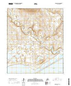
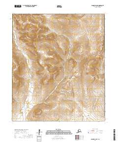
2017 Map of Solomon C-6 SE
USGS Topo · Published 2017About this map
Safety Sound and the barrier coast of the Seward Peninsula dominate this coastal survey, where the freshwater systems of the interior meet the tidal reaches of the Bering Sea. The landscape is defined by the braided path of the Bonanza River as it winds south toward Norton Sound, joined by numerous tributaries including Gold Run Cr, Ohio Cr, and Jackson Cr. This network of waterways suggests the complex drainage patterns of the Alaskan tundra during the early 21st century. Along the southern edge, the Council Road provides the primary overland transit corridor, tracing the narrow strip of land between the sound and the mainland. The map captures a moment in the region's modern geography, showing the persistence of traditional transport routes in a terrain heavily influenced by shifting seasonal waters and coastal morphology.
Find a feature on this map
14 named features on this map. Tap any name to fly to it.
Don’t see what you’re looking for? This feature index may not catch every label — zoom into the map to look around manually.
Map Details
Editions of this 2017 Solomon C-6 SE Map
This is the sole edition of this map. No revisions or reprints were ever made.
Other maps of this area

1907 · Solomon
USGS Topo · 1:62,500

1950 · Solomon C-5
USGS Topo · 1:63,360

1950 · Solomon C-6
USGS Topo · 1:63,360

1950 · Solomon B-6
USGS Topo · 1:63,360

1950 · Solomon
USGS Topo · 1:250,000

1951 · Solomon
USGS Topo · 1:250,000
2014 · Solomon B-6 NE
USGS Topo · 1:25,000
2017 · Solomon C-6 NW
USGS Topo · 1:25,000
2017 · Solomon C-5 NW
USGS Topo · 1:25,000
2017 · Solomon C-6 NE
USGS Topo · 1:25,000