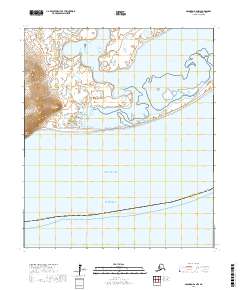
2017 Map of Solomon B-6 NW
USGS Topo · Published 2017About this map
Cape Nome stands as a prominent coastal landmark on the southern edge of the Seward Peninsula, where the land meets the cold waters of Norton Sound. This coastal region is defined by the expansive and complex waters of Safety Sound, a shallow lagoon system protected by narrow barrier spits. These spits are traversed by the Council Road, which provides the primary land-based connection across the lagoon's mouth at Port Safety.
Find a feature on this map
16 named features on this map. Tap any name to fly to it.
Don’t see what you’re looking for? This feature index may not catch every label — zoom into the map to look around manually.
Map Details
Editions of this 2017 Solomon B-6 NW Map
This is the sole edition of this map. No revisions or reprints were ever made.
Other maps of this area

1950 · Nome
USGS Topo · 1:250,000

1950 · Solomon C-6
USGS Topo · 1:63,360

1950 · Nome B-1
USGS Topo · 1:63,360

1950 · Solomon B-6
USGS Topo · 1:63,360

1950 · Solomon
USGS Topo · 1:250,000

1950 · Nome C-1
USGS Topo · 1:63,360

1951 · Nome
USGS Topo · 1:250,000

1951 · Solomon
USGS Topo · 1:250,000

1957 · Nome
USGS Topo · 1:250,000
2014 · Solomon B-6 NE
USGS Topo · 1:25,000