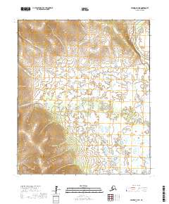
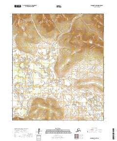
2017 Map of Solomon C-4 NE
USGS Topo · Published 2017About this map
The Seward Peninsula landscape is defined by its complex drainage systems and varied elevation in this 2017 study. The Fish River dominates the northeastern corner, accompanied by the descriptively named Telephone Slough, which indicates early communication infrastructure in the Alaskan wilderness. To the south and west, the Klokerblok River meanders through a labyrinth of wetlands and small lakes, demonstrating the shifting nature of the arctic terrain.
Find a feature on this map
13 named features on this map. Tap any name to fly to it.
Don’t see what you’re looking for? This feature index may not catch every label — zoom into the map to look around manually.
Map Details
Editions of this 2017 Solomon C-4 NE Map
This is the sole edition of this map. No revisions or reprints were ever made.
Other maps of this area

1950 · Solomon C-4
USGS Topo · 1:63,360

1950 · Solomon D-3
USGS Topo · 1:63,360

1950 · Solomon
USGS Topo · 1:250,000

1950 · Solomon C-3
USGS Topo · 1:63,360

1950 · Solomon D-4
USGS Topo · 1:63,360

1951 · Solomon
USGS Topo · 1:250,000
2017 · Solomon C-3 NW
USGS Topo · 1:25,000
2017 · Solomon C-4 NW
USGS Topo · 1:25,000
2017 · Solomon D-4 SE
USGS Topo · 1:25,000
2017 · Solomon D-3 SW
USGS Topo · 1:25,000