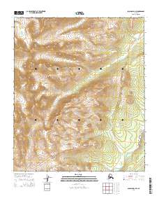
2014 Map of Solomon D-1 SW
USGS Topo · Published 2014About this map
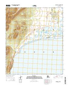
Darby Mountains dominate this high-latitude terrain, where the elevation rises steeply through the central and western portions of the sheet. The landscape is defined by the drainage patterns of Clear Cr, which flows through the high valleys, and the Kwinluk River in the southeastern corner. This 2014 representation of the Nome region reflects a purely wilderness character, devoid of any modern structures, roads, or named human settlements. The contour lines reveal a complex network of ridgelines and steep basins, illustrating the remote hydrological environment typical of the Seward Peninsula. The inclusion of Public Land Survey System township and range boundaries, such as t7s r19w and t8s r18w, provides the primary organizational framework for this largely untouched expanse.
Find a feature on this map
7 named features on this map. Tap any name to fly to it.
Don’t see what you’re looking for? This feature index may not catch every label — zoom into the map to look around manually.
Map Details
Editions of this 2014 Solomon D-1 SW Map
This is the sole edition of this map. No revisions or reprints were ever made.
Other maps of this area

1950 · Solomon D-2
USGS Topo · 1:63,360

1950 · Solomon C-2
USGS Topo · 1:63,360

1950 · Solomon C-1
USGS Topo · 1:63,360

1950 · Solomon D-1
USGS Topo · 1:63,360

1950 · Solomon
USGS Topo · 1:250,000

1951 · Solomon
USGS Topo · 1:250,000
2014 · Solomon D-1 NE
USGS Topo · 1:25,000
2014 · Solomon D-2 SE
USGS Topo · 1:25,000
2014 · Solomon D-1 NW
USGS Topo · 1:25,000
2014 · Solomon C-1 NE
USGS Topo · 1:25,000