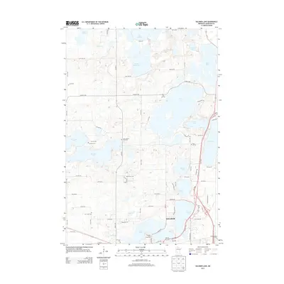
2013 Map of Solomon Lake
USGS Topo · Published 2013About this map
The city of Willmar anchors this central Minnesota landscape, where the prairie begins to break into a dense network of glacial lakes. In the early 21st century, the northern expansion of the city is evident near Ridgewater Coll and the Kandiyohi County Fairgrounds. The map is particularly valuable for genealogical research, documenting numerous small burial grounds and parish sites that mark early settlement patterns, including Vikor Lutheran Church Cem, Endresen Cem, and Saint Johns Cem.
Find a feature on this map
81 named features on this map. Tap any name to fly to it.
Don’t see what you’re looking for? This feature index may not catch every label — zoom into the map to look around manually.
Map Details
Editions of this 2013 Solomon Lake Map
This is the sole edition of this map. No revisions or reprints were ever made.
Other maps of this area

1953 · Saint Cloud
USGS Topo · 1:250,000

1956 · Atwater
USGS Topo · 1:62,500

1957 · Saint Cloud
USGS Topo · 1:250,000

1958 · Saint Cloud
USGS Topo · 1:250,000

1958 · Raymond
USGS Topo · 1:24,000

1958 · Pennock
USGS Topo · 1:24,000

1958 · Willmar
USGS Topo · 1:24,000

1958 · Solomon Lake
USGS Topo · 1:24,000

1967 · Mount Tom
USGS Topo · 1:24,000

1967 · Sunburg
USGS Topo · 1:24,000