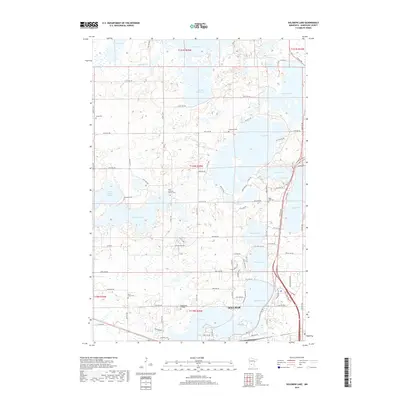
2019 Map of Solomon Lake
USGS Topo · Published 2019About this map
Willmar occupies the southern edge of this landscape, where the urban grid meets the recreational and institutional grounds of Ridgewater College. The area is defined by an intricate network of glacial lakes, including the central Solomon Lake and the connected Foot Lake and Willmar Lake systems. These water bodies, along with smaller features like Skataas Lake and Swan Lake, reflect the region's post-glacial topography. Genealogy and local history are particularly well-represented through numerous burial grounds scattered across the townships, such as Vikor Lutheran Church Cem, Endresen Cem, and Lunby Cem. The map illustrates the transition from the structured residential and educational expansion of the city into the surrounding agricultural sections, divided by a grid of county roads and avenues that connect the diverse lake shorelines.
Find a feature on this map
97 named features on this map. Tap any name to fly to it.
Don’t see what you’re looking for? This feature index may not catch every label — zoom into the map to look around manually.
Map Details
Editions of this 2019 Solomon Lake Map
This is the sole edition of this map. No revisions or reprints were ever made.
Other maps of this area

1953 · Saint Cloud
USGS Topo · 1:250,000

1956 · Atwater
USGS Topo · 1:62,500

1957 · Saint Cloud
USGS Topo · 1:250,000

1958 · Saint Cloud
USGS Topo · 1:250,000

1958 · Raymond
USGS Topo · 1:24,000

1958 · Pennock
USGS Topo · 1:24,000

1958 · Willmar
USGS Topo · 1:24,000

1958 · Solomon Lake
USGS Topo · 1:24,000

1967 · Mount Tom
USGS Topo · 1:24,000

1967 · Sunburg
USGS Topo · 1:24,000